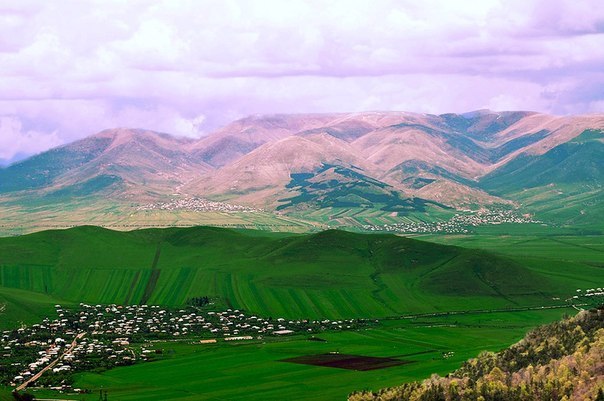
Chabarak - Dzoravan Trail is located in Gegharkunik Province. Gegharkunik has a mountainous landscape. The territory is dominated by Geghama Mountains from the west, Vadenis Mountains from the south, Sevan Mountains from the east, Miapor Mountains from the northeast and the Kenats mountains from the north. The height of the mountains ranges between 2500 and 3500 meters. The climate of Gegharkunik is cold and snowy in winter, while the summer is characterized with warm and humid climate. You will definitely enjoy the fascinating views of Lake Sevan at some sections of the trail.
Overall trail data
Trail Length: 53.6 km
Trail Duration: 20-25 Hours
Elevation: 1921 m
Ascent: 2261 m
Descent: 2966 m
Difficulty: Intermediate
Rescue Service: 911, 112
Trail Functionality Symbols: Hike, Horse, Bike
Section 1: Chambarak – Nerkin Chambarak – Ttujur - Getik
Trail Length: 14.2 km
Trail Duration: 5-6 Hours
Elevation: 1868 m
Ascent: 228 m
Descent: 396 m
Difficulty: Easy
Trail Functionality Symbols – Hike, Horse, Bike
Section 2: Getik – Martuni – Old Getik Monastery - Mnatsavan
Trail Length: 7.7 km
Trail Duration: 3-4 Hours
Elevation: 1782 m
Ascent: 289 m
Descent: 483 m
Difficulty: Intermediate
Trail Functionality Symbols: Hike, Horse, Bike
Section 3: Mnatsavan - Aygut
Trail Length: 8.8 km
Trail Duration: 3-4 Hours
Elevation: 1906 m
Ascent: 534 m
Descent: 620 m
Difficulty: Intermediate
Trail Functionality Symbols: Hike, Horse,
Section 4: Aygut – Dprabak
Trail Length: 7.3 km
Trail Duration: 3-4 Hours
Elevation: 1720 m
Ascent: 390 m
Descent: 504 m
Difficulty: Intermediate
Trail Functionality Symbols: Hike, Horse, Bike
Section 5: Dprabak - Kalavan
Trail Length: 8.2 km
Trail Duration: 3-4 Hours
Elevation: 1922 m
Ascent: 677 m
Descent: 398 m
Difficulty: Intermediate
Trail Functionality Symbols: Hike, Horse, Bike, Jeeping
Section 6: Kalavan - Dzoravank
Trail Length: 7.6 km
Trail Duration: 3-4 Hours
Elevation: 1749 m
Ascent: 259 m
Descent: 680 m
Difficulty: Intermediate
Trail Functionality Symbols: Hike, Horse, Bike, Jeeping
How to get there?
Considering the fact that you will start the trail somewhere and will finish it somewhere else, you will need a car-support to pick you up from 'end-points'.
Where to stay?
Check out the Accommodation section!
What to see around?
To be published shortly
Nearby destinations
To be published shortly
GPS track
To be published shortly